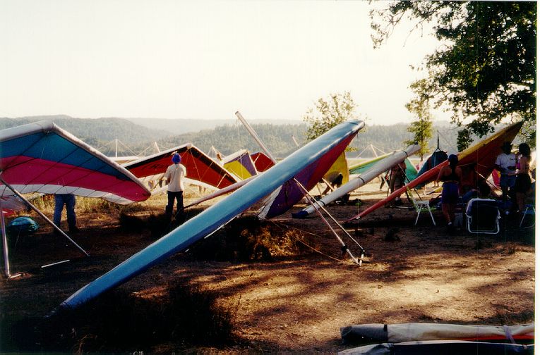
Hull Mountain / Lake Pillsbury
Click on any image to see a larger version
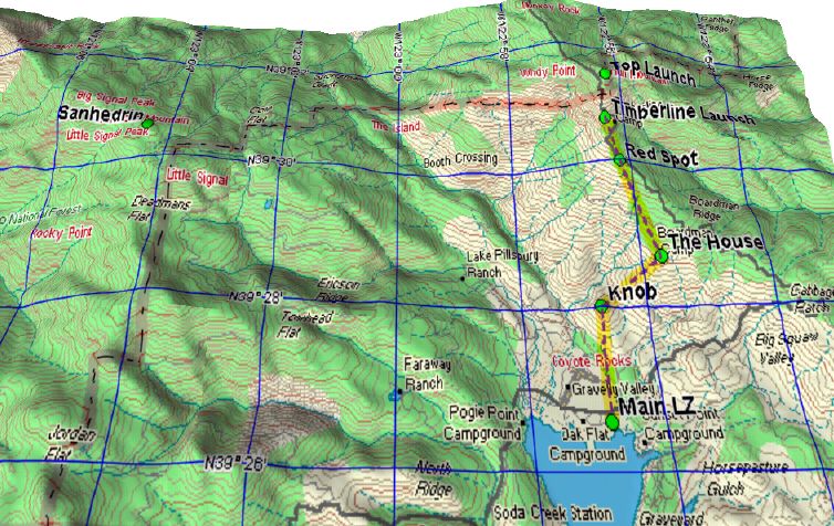
Map of Lake Pillsbury basin.
The most common route from Timberline Launch to the primary LZ is shown. We tend to fly the area encompassed by Monkey Rock to the north, the dam to the south, Sanhedrin to the west, and Rattlesnake Canyon to the east.
The most common route from Timberline Launch to the primary LZ is shown. We tend to fly the area encompassed by Monkey Rock to the north, the dam to the south, Sanhedrin to the west, and Rattlesnake Canyon to the east.
map © Delorme, Topo USA 2.0
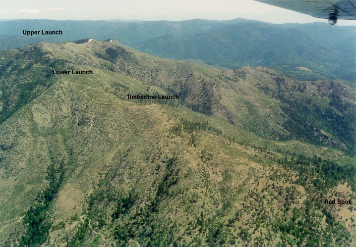
Hull Mtn & Boardman Ridge.
Looking northeast.
Upper Launch, Lower Launch, Timberline Launch and Red Spot are labeled. Leo cheated on this shot, flying with Vince Endter in his Cardinal :)
Photo © Leo Jones (photo from plane)
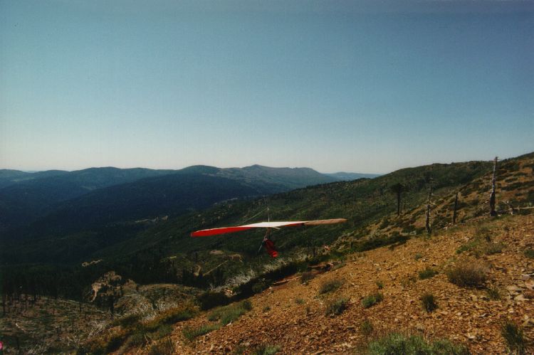
Launching at Timberline.
Launch faces west/northwest. Windy Ridge (called Windy Point on the map) and Sanhedrin Mt. are in the background, above the glider.
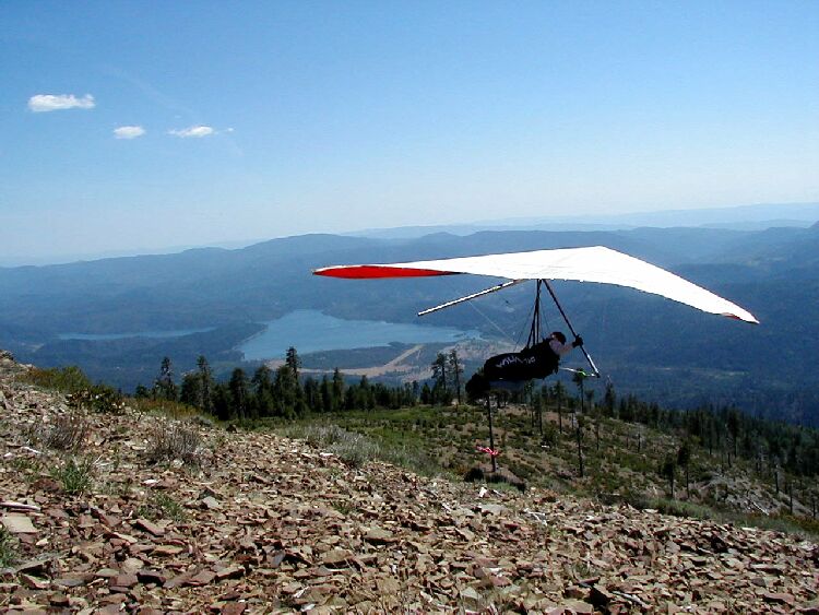
Shawn Stiver Launching at Timberline.
This view of launch shows the lake in the background.
Photo © Lynne Smith
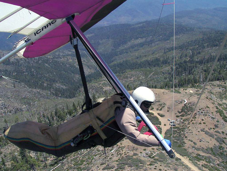
Mike Kunitani, over Timberline launch.
You can see Ernie walking his glider up to the launch area (right
in front of Mike's front flying wire). Launch direction
is towards the right.
Photo © Mike Kunitani, 2001
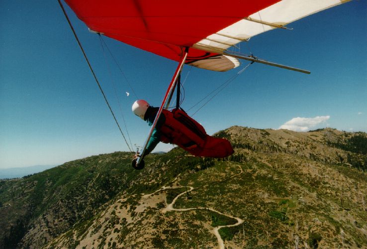
Climbing out above Timberline Launch
To the north Jon James is climbing out above Lower Launch (it's below my wheel).
The top of Hull can be seen above my feet.
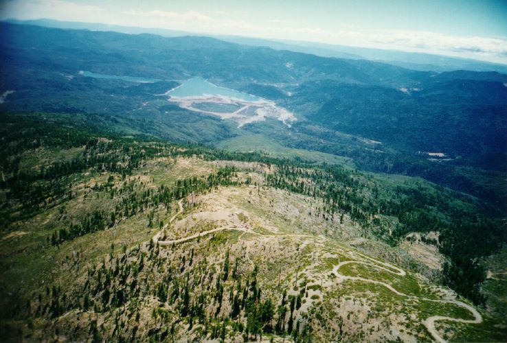
Looking back at Timberline Launch and the lake to the south/southwest.
If you look closely you can see a few gliders in the setup area and one glider making its way to the takeoff spot.
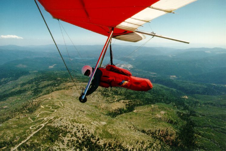
Higher and closer to the peak of Hull. Lower Launch is in the foreground. If you can see Timberline Launch you're doing good. You're doing even better if you can make out the two gliders working low near Lower Launch (it looks like a loop off to the right of the road).
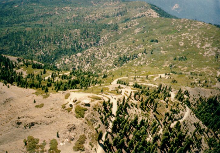
Higher yet, you get above Hull Mtn. peak at 6880 ft. This photo is from 1986, when the fire lookout was still in place. Now there's nothing - fire and vandals leveled it. Windy Ridge is in the upper-right of the photo, Boardman Ridge comes up from the middle-left, and Rattlesnake Canyon is off to the bottom-left.
From the peak you can use the NW "rockslide", W "ramp" (now gone), SW "propane tank" or SE "backside" launches.
From the peak you can use the NW "rockslide", W "ramp" (now gone), SW "propane tank" or SE "backside" launches.
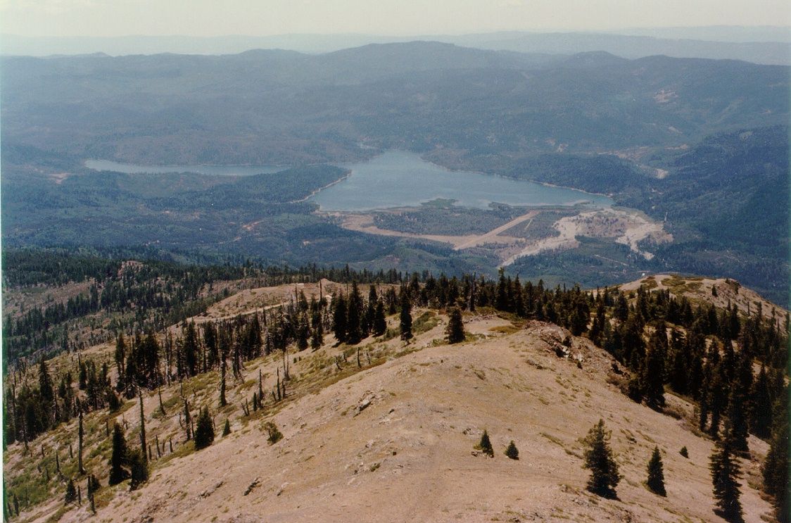
A view from the "propane tank" toward the lake.
At the right edge of the photo is Lower Launch (seldom used). To its left, at the bottom of the bare ridge, is Timberline Launch. You can see a glider in the setup/parking area, just off the road. Above its nose is the Launch itself. You can also see the Knob, at the bottom of the ridge rising up at this end of the runway. Rattlesnake Canyon is off the left edge of the photo.
Photo © Cliff Olling
At the right edge of the photo is Lower Launch (seldom used). To its left, at the bottom of the bare ridge, is Timberline Launch. You can see a glider in the setup/parking area, just off the road. Above its nose is the Launch itself. You can also see the Knob, at the bottom of the ridge rising up at this end of the runway. Rattlesnake Canyon is off the left edge of the photo.
Photo © Cliff Olling
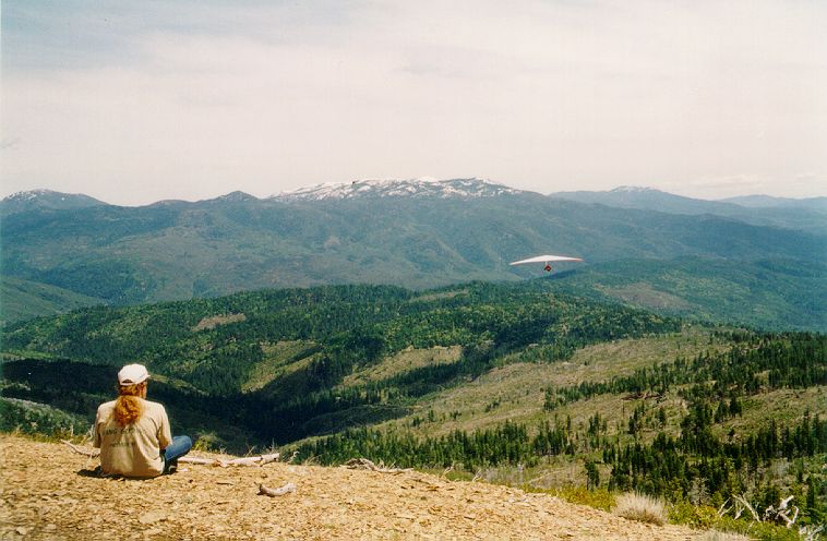
Charlie Warren watches Todd Robinson launch NE into Rattlesnake Canyon.
Todd will eventually head right to cross over Boardman Ridge (seen under him). In the distance is the aptly-named Snow Mt. At the very left of the photo is St. John Mt.
Photo © Leo Jones - June 1997
Todd will eventually head right to cross over Boardman Ridge (seen under him). In the distance is the aptly-named Snow Mt. At the very left of the photo is St. John Mt.
Photo © Leo Jones - June 1997
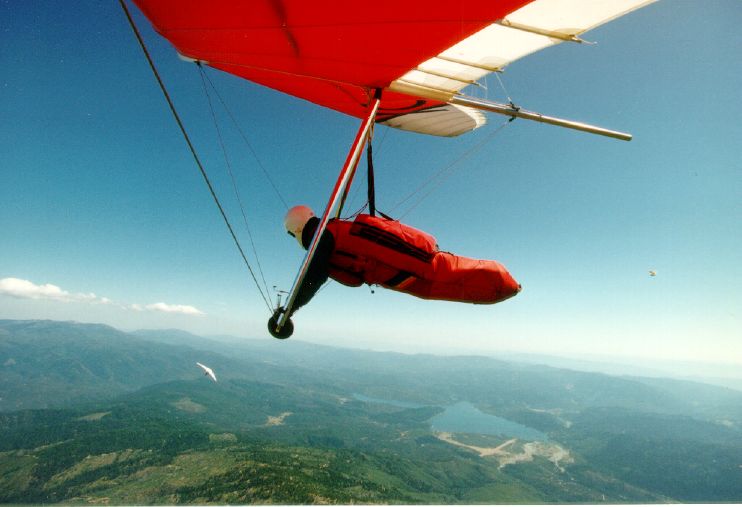
And still higher, you get a nice view of the Lake Pillsbury basin.
A couple of other gliders share the air.
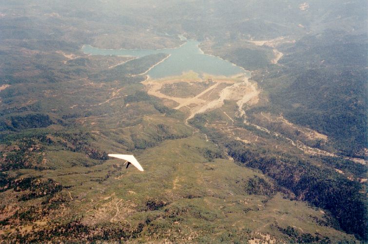
Matt Jagelka over Boardman Ridge at 12,000 ft.
Right above this end of the airstrip is the "Knob" (Matt's nose points to it), and where that secondary ridge joins the main Boardman Ridge is the "House" (to Matt's left). The "House" is a consistent thermal source, and the "Knob" is the last-chance thermal source. They're both on the normal route to the LZ. Timberline Launch is off the bottom-right corner of the photo.
Photo © Leo Jones - July 1997
Right above this end of the airstrip is the "Knob" (Matt's nose points to it), and where that secondary ridge joins the main Boardman Ridge is the "House" (to Matt's left). The "House" is a consistent thermal source, and the "Knob" is the last-chance thermal source. They're both on the normal route to the LZ. Timberline Launch is off the bottom-right corner of the photo.
Photo © Leo Jones - July 1997
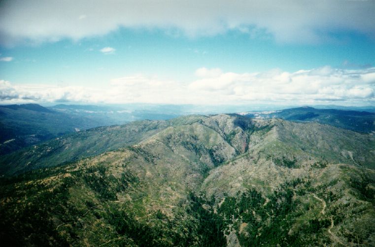
If you go east, on a line with the airstrip, about 3 miles past Boardman Ridge, you'll find yourself here. This photo is from above Rattlesnake canyon looking north at the peak. Boardman Ridge, the road to the top, is on the left. Beyond it, heading west from the peak, is Windy Gap, and beyond that Sanhedrin Mt. Rattlesnake used to be heavily wooded before the fire of '86. Sanhedrin's east flank burned too.
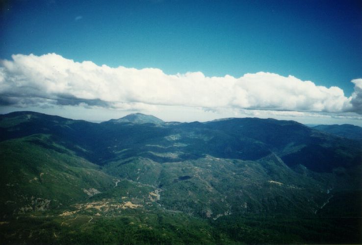
After taking the previous photo, turn around to the east/southeast and you'll see St. John Mtn., and to its right, Snow Mtn.
Only a few pilots have attempted the crossing from Hull to St. John. With practically no roads, and fewer LZ's, this is truly dinasaur country.
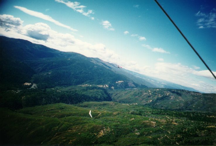
A closer look at Windy Ridge and Mt. Sanhedrin (the burned area around the higher glider just touching the horizon). The brown patch at the left edge of the photo is the polo field, part of Pillsbury Ranch.
History: Double Eagle V, the first balloon to cross the Pacific, landed on the east flank of Sanhedrin (11/12/1981). Onboard was Larry Newman, onetime owner of Electra Flyer.
History: Double Eagle V, the first balloon to cross the Pacific, landed on the east flank of Sanhedrin (11/12/1981). Onboard was Larry Newman, onetime owner of Electra Flyer.
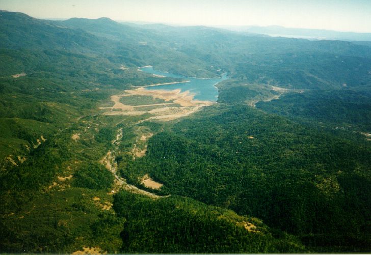
Looking south from near Windy Ridge towards the lake. Lake Pillsbury Ranch and its polo field are imediateley below. Notice how low the lake water gets by the end of the summer (most years).
History: Pillsbury Ranch was owned by the Fuller Brush Man, then by the Tin Man from Wizard of Oz.
History: Pillsbury Ranch was owned by the Fuller Brush Man, then by the Tin Man from Wizard of Oz.
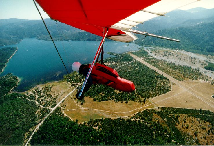
Approaching the landing area. The primary LZ is where the corner of the trees is closest to the lake (just to the left of Ernie's helmet). The secondary LZ is near the "cross runway" on Gravelly Valley Airstrip - the large bare area seen to the rear of Ernie's feet. Don't land on the runway.
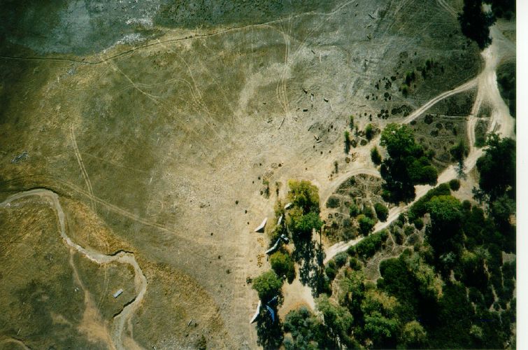
Overhead shot of the Primary LZ. You can make out the circle of the spot landing target, just to the left of the glider in the open. During the spring, the lake comes up to this target circle and we have to land further back in the slot that leads to the road.
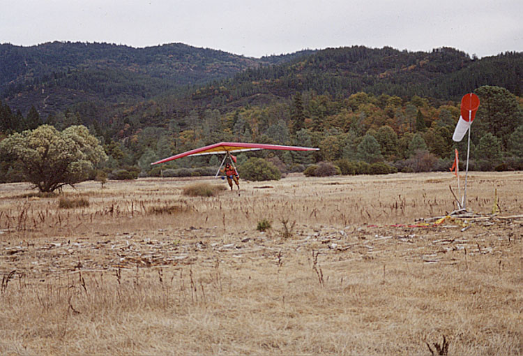
Kurt Bainum on final to the LZ.
The spot is to the left of the windsock. It looks like Kurt
will come up just a tad short.
Photo © Ernie Camacho - August 2001
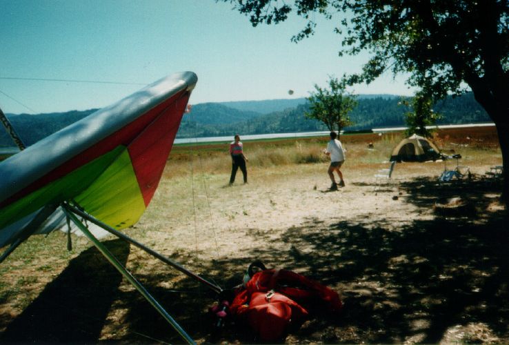
Lake Pillsbury LZ.
We used to camp right here, but it's no longer allowed. We now camp further to the right along the shore at Oak Flat Campground (no fee), or any of the fee camgrounds around this end of the lake (Fuller Grove, Pogie Pt., Navy Camp, Sunset).