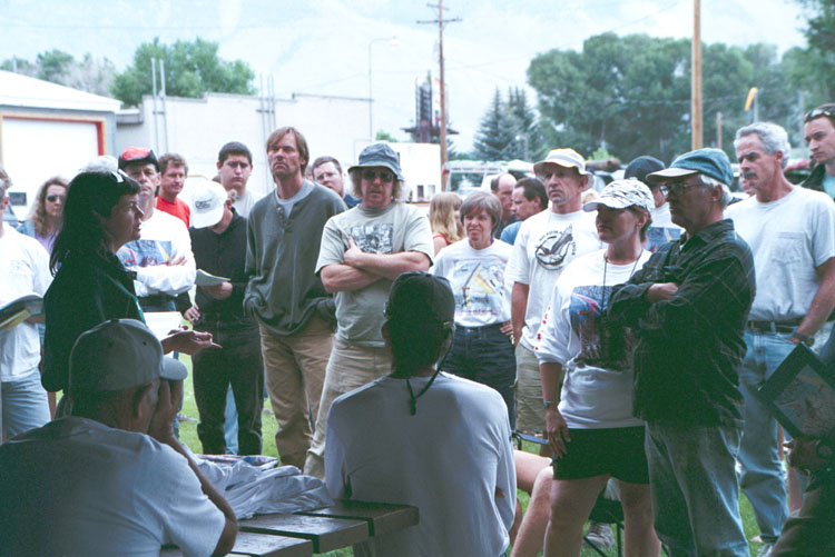
King Mtn. - Moore Idaho
Click on any image to see a larger version
King Mt., Idaho, is a site that compares quite favorably with the Owens Valley: mountain ranges towering to 12,000 ft. above 5,000 ft. valleys; booming thermals; outrageous turbulence; and the promise of long XC flights.
These photos and maps should give you a feel for what the area looks like. They were taken starting in 1999,
the first time Sonoma Wings made an appearance at the King Mt. meet, held the first weekend after July 4th (3 pilots);
in 2000, the year that Sonoma Wings had an epic adventure there (8 pilots for the week leading up to the meet);
and in the years since then.
Here are some stories (and photos) about the King Meets, starting in 2000:
Here is a list of waypoints for the 3 routes:
Here's the Fly King Mountain website, with meet information:
Maps of King Mt.
- Lost River Range, showing the 3 major XC routes.
- Another view of the XC routes, emphasizing the terrain.
- 4 maps of XC route 1, to Salmon.
- 5 maps of a GPS track up route 1 to Challis.
- 5 maps of 5 GPS tracks up route 1 to Challis.
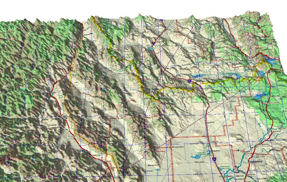
map © Delorme, Topo USA 2.0
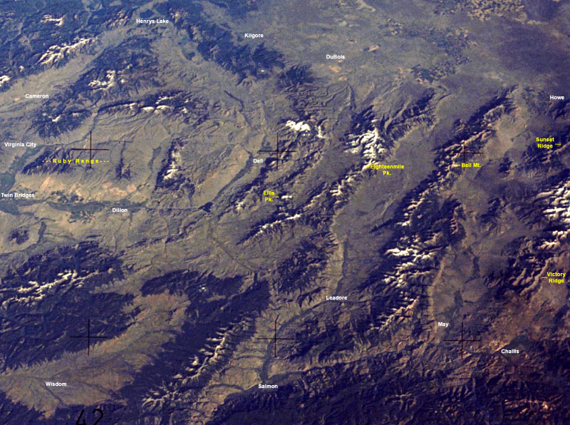
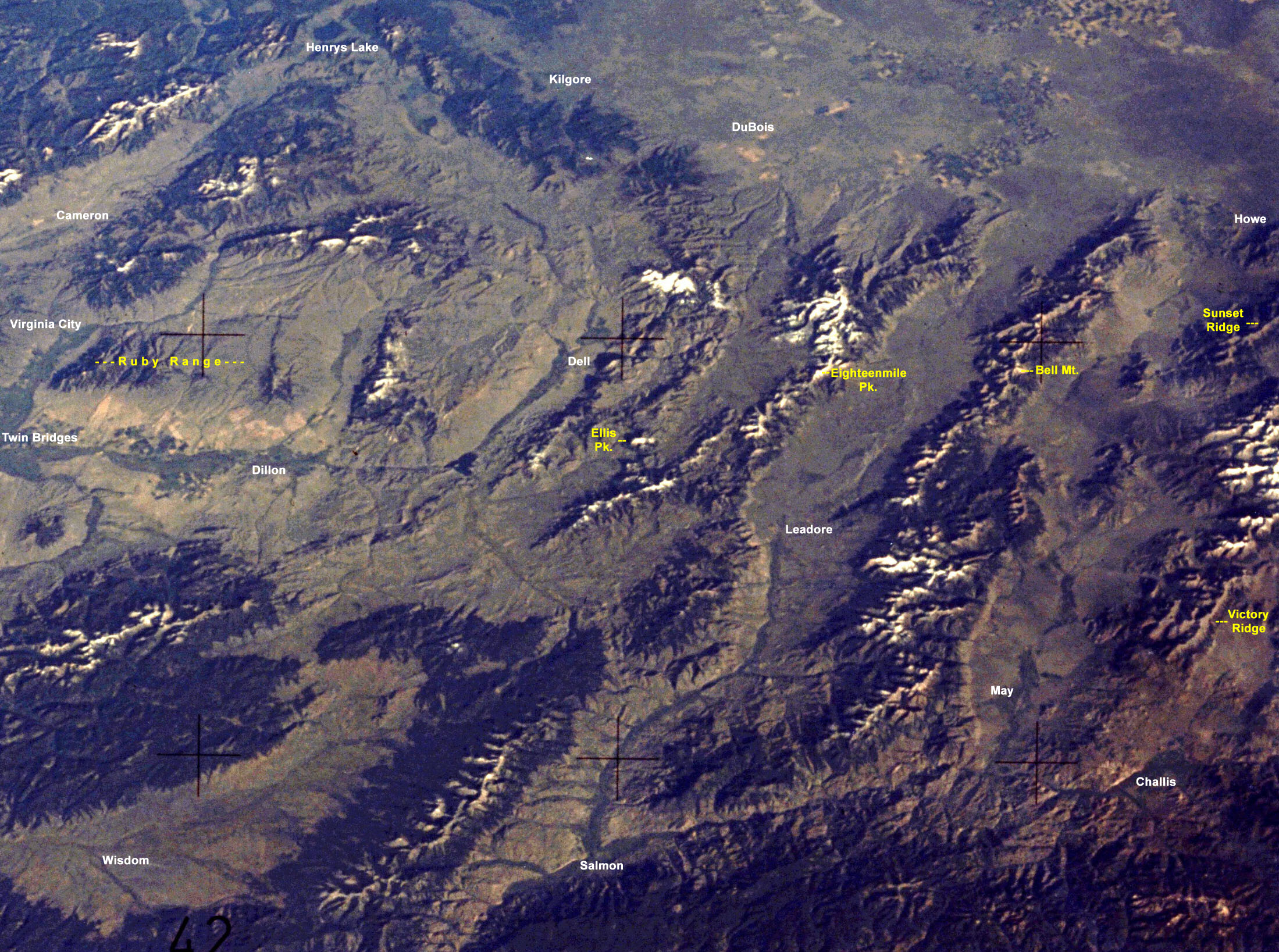
Satellite photo of King Routes.
King Launch and the first part of Route 1 is not shown. Camera is facing SE.
To make a print for reference:
- use a color inkjet printer & photo-quality paper.
- download this 1.1mb version
(right-click / save to disk or open image, then save).
- Get yourself a free copy of Irfanview and use it to print
the image on a single page, landscape, best fit.
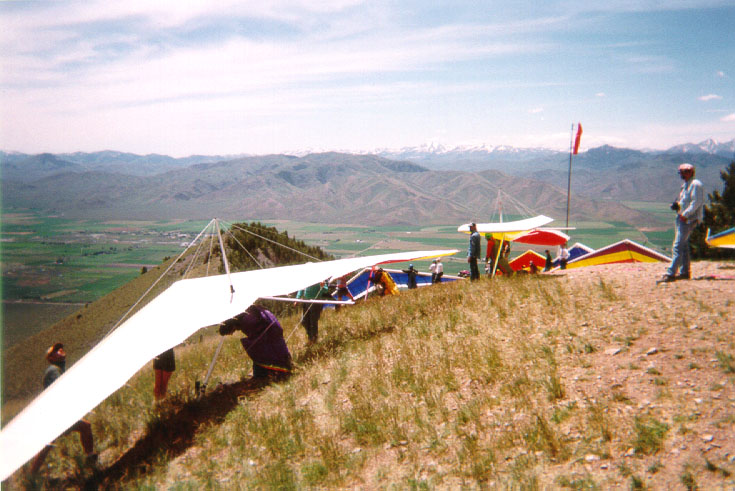
Upper Launch, camera is facing WSW.
This south-facing launch is nice and open, allowing two rows of pilots to launch.
The NW-facing ramp launch is beyond the wind sock.
Photo © Scot Huber, June, 1999
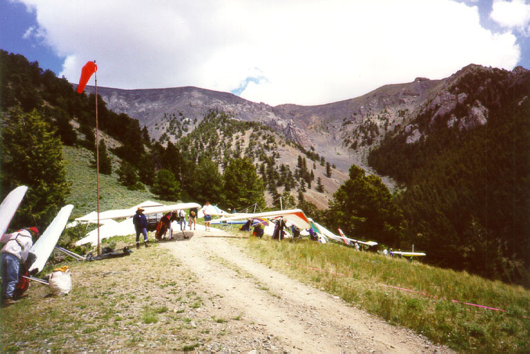
Upper Launch, camera is facing NE.
You can see the setup areas and the two lines for launch.
The top of King is visible in the distance. It stretches off to the left. Directly to the left of the camera is the ramp launch, facing to the left.
Photo © Ernie Camacho, June, 1999
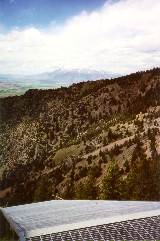
Ramp Launch, camera facing NW.
You can see the peaks near Mackay in the distance. Mt. McCaleb is the tallest peak on the left, Invisible Mt. is on the right.
Photo © Ernie Camacho, June 1999
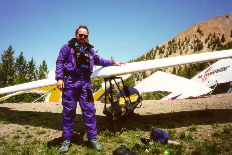
Al Whitesell, setting up at the upper launch.
You can see the top of King in the background. Al, on his Millenium, took first place in the meet.
Photo © Ernie Camacho, June 1999
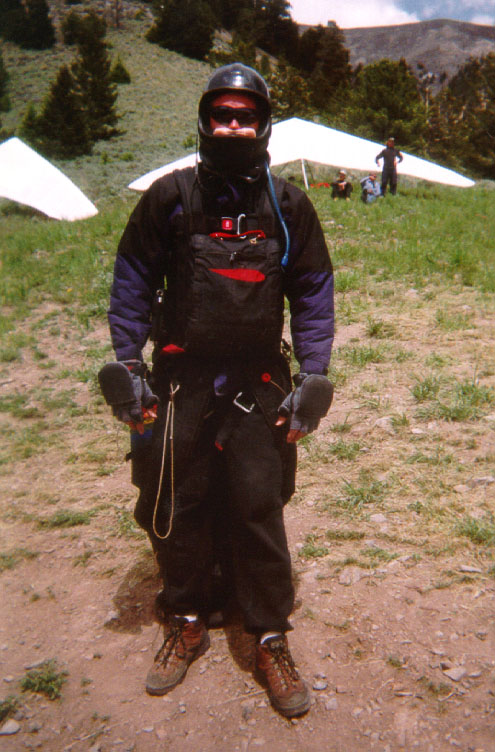
Scot Huber, all dressed up and no place to go.
What the well-dressed XC pilot will wear, including Oxygen (the pink mustache), water, radio, GPS, and warm clothes.
Photo © Scot Huber, June 1999
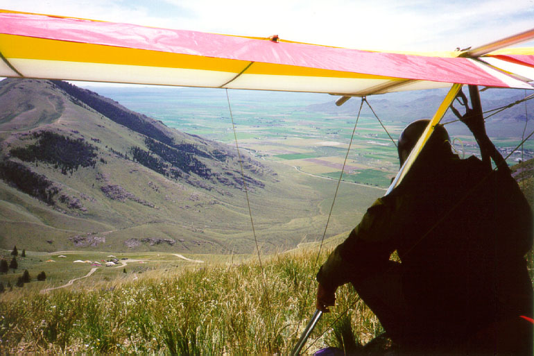
Kevin Frost and his Exxtacy, ready to launch.
Lower launch is below. The bailout LZ is behind Kevin's head.
An alternate NW-facing launch (Coyote) is visible on the ridge at the left of the photo.
Photo © Ernie Camacho, June 1999
Lower Launch, prefered by PG pilots, and HG'ers in higher winds.
The bailout LZ can be seen above the vehicles, at the road intersection. The town of Moore, Idaho, meet headquarters, is in the valley beyond.
Photo © Ernie Camacho, June 1999
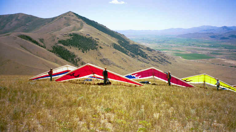
Gliders set up at Lower Launch.
Photo © Donna Mathias, July 2000
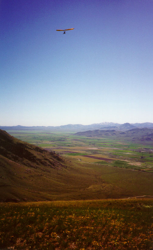
Scot Huber, on his La Mouette Topless, climbing out above Lower Launch.
Photo © Ernie Camacho, June, 1999
Climbing up to the top of King.
Upper Launch, Lower Launch, the Bailout LZ (right edge of photo), and the Arco-Moore area are all spread out below.
Photo © Albert Branson, July, 2000
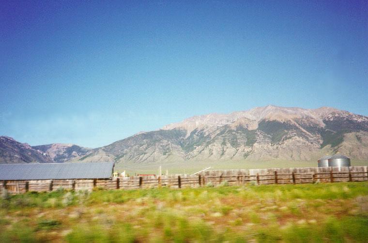
King Mountain.
The Upper Launch ridge can be seen directly above the right-hand silo, about half way up the mountain. If you look closely, you can see the road on the ridge top, and the cleared spot to the left of it that is the Ramp Launch.
Ramshorn canyon is above the barn.
Camera is facing NE.
Photo © Ernie Camacho, June, 1999
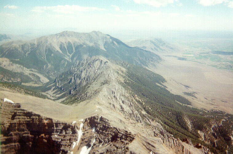
On Sunset Ridge.
Camera is facing SE. To the left is the back end of Ramshorn canyon. Straight ahead is Sunset Ridge, with King Mt. in the background. You can see the upper launch - the hump on the mountain's flank.
Here is another image, taken from 14,000 ft. by Ernie, 6/2004
Photo © Ernie Camacho, July, 2000

Leaving Sunset Ridge.
Pass Creek Rd., (north-south) comes in from the left of the photo, and
continues out Pass Creek Canyon, behind Ernie's head, and into the Lemhi valley. Invisible Mt. is just below the wind tell-tale
on the front flying wire.
Camera is facing NW.
Photo © Ernie Camacho, June, 2002
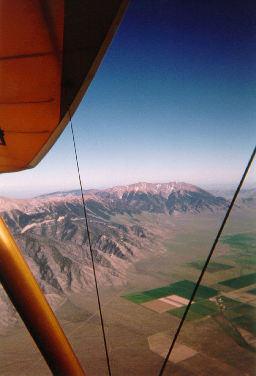
Looking back at King. Camera is facing SE.
The launch ridge is the small bump at the right edge of King, about a third of the way up. Take-off faces South. To the left of King is Ramshorn Canyon, then Sunset ridge, heading back into the Pass Creek Rd. corner off the lower-left of the photo. Sunset Peak is off the left side of the photo.
Photo © Scot Huber, June, 1999
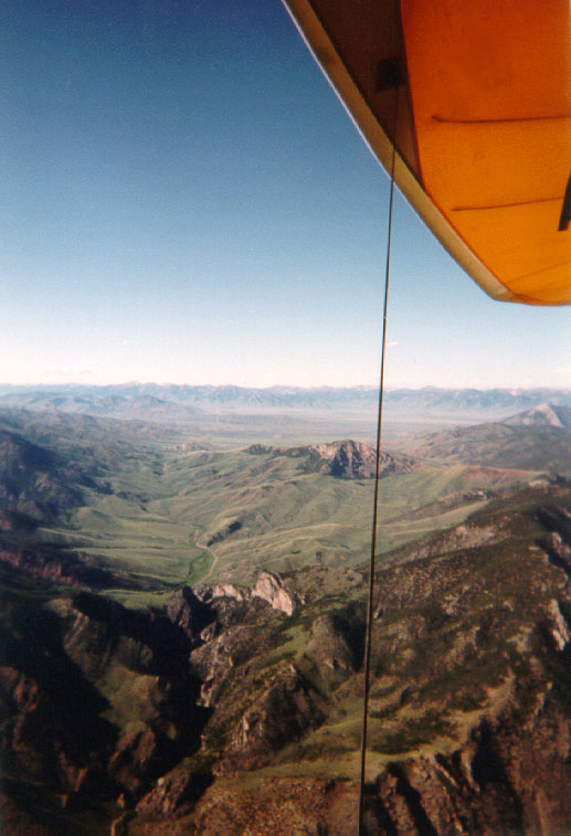
Looking North, up Pass Creek Rd.
This photo was taken from the same spot as the previous one. You can see into the next valley, with the Lemhi range beyond. That is the direction you'd be heading if you took XC route no. 2 towards Dell Montana and Three Forks (in Gallatin County). Sunset Peak is to the right of this photo.
Photo © Scot Huber, June, 1999
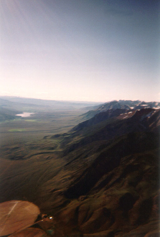
Looking along the course line to the North West.
The flanks of Invisible Mt. are in the foreground. Mackay reservour is in the distance.
The town of Mackay is off to the left of this photo.
Photo © Scot Huber, June,1999
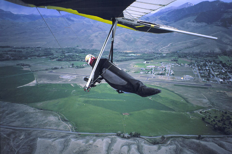
Ernie approaching Mackay Airport.
Mackay is the first bonus LZ for recreation class competitors. It's 18.5 miles from launch.
We tend to land near the asphalt apron, shown above Ernie's feet.
North-South Hwy 93 runs along the far side of the runway. The town of Mackay is at the right-rear of the photo.
The camera is facing West.
Photo © Ernie Camacho, June, 2002
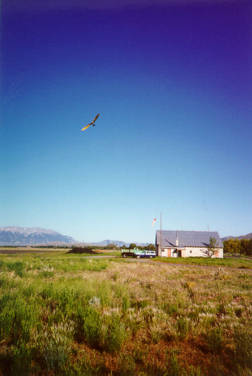
Scot coming in to land at Mackay airport.
You can see King Mt. in the background, 20 miles away.
Photo © Ernie Camacho, June, 1999
Mt. McCaleb, North of Mackay.
Notice McCaleb's unique lava 'hat'. Mackay Reservour is at the left side of the photo. Leatherman Pk. is at the top-right. The camera is facing NW.
Photo © Albert Branson, July, 2000
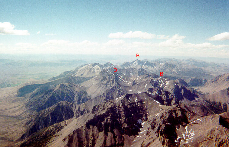
Over Mt. McCaleb, looking to the NW.
Mt. Breitenbach, Donaldson Peak, Leatherman Peak & Borah Peak are labeled in the large photo. Just follow the peaks to Borah.
Photo © Ernie Camacho, July, 2000
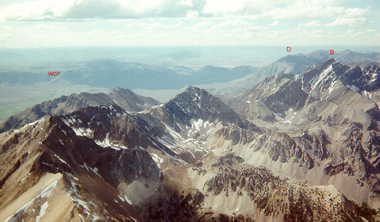
Approaching Borah.
Borah Pk. is on the right. Dickey Pk. is in the background. The highway going up through Willow Creek Pass is in the far left background.
Photo © Ernie Camacho, July, 2000
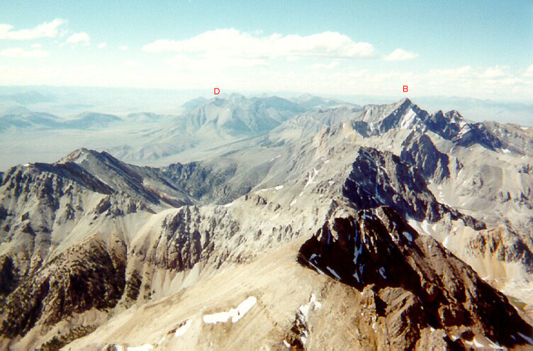
Borah Peak, highest point in Idaho.
From this angle you can see May-Patterson Rd. at the base of Dickey Pk.
Photo © Ernie Camacho, July, 2000
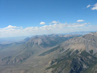
Dickey Peak & May-Patterson Rd.
May-Patterson Rd. is also called Doublespring Pass Rd.
Dickey Pk. is the start of the Pahsimeroi Range / Victory Ridge / Ginzu Ridge.
Camera is facing N.
Photo © Kevin Frost, June, 2003

Over Dickey Peak, looking south.
May-Patterson Rd. is in the middle distance.
Snow-draped Borah Peak is at the top-left of the photo.
Vince took this photo on the return leg of his 100 mi. out-and-return
flight.
Photo © Vince Endter, July, 2001
Borah Peak, as seen from Hwy. 93.
Kevin's ATOS is parked in the Willow Creek Summit bonus LZ, used during the King Mt. meet.
Snow-draped Borah Peak is at center-rear of the photo.
Kevin took this photo during the 2003 King Meet.
Camera is facing SE.
Photo © Kevin Frost, June, 2003
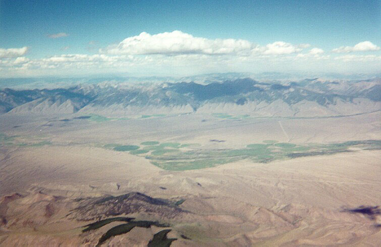
Looking East at the Lemhi's.
Leaving "Ginzu" Ridge for the Lemhi Mts. Patterson is straight ahead, May is off to the left.
(these are not towns - just placenames. Look for a farm - that's the 'town')
Photo © Ernie Camacho, July, 2000
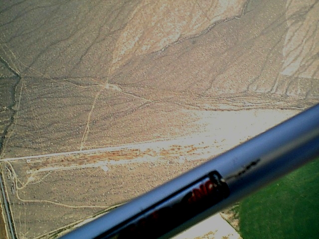
May Airstrip.
This "bonus LZ" has been used instead of Challis Airport since the
2001 King Meet.
The road from Ellis is called Pahsimeroi Rd. or Farm-to-Market Rd.
or FM Rd., depending on what map you consult. You can see it running
vertically (N-S) in the lower-left of the photo. The dirt airstrip
runs left to right in the middle of the photo, with a parallel dirt road
just to its North. Here's a MAP of the
area to help put it in perspective.
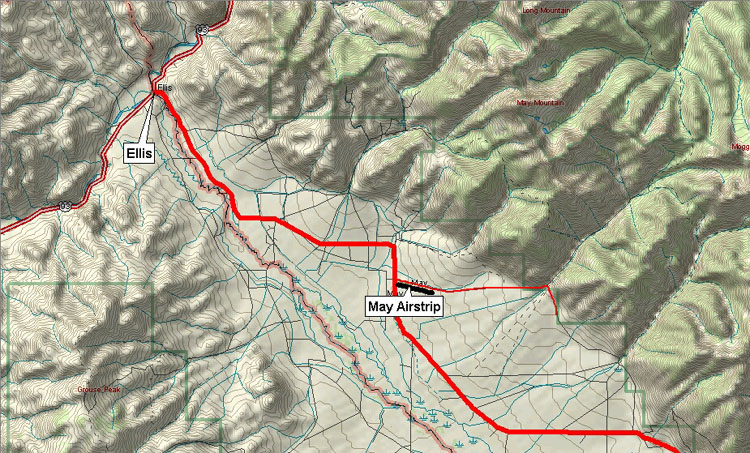
Photo © Kevin Frost, June, 2001
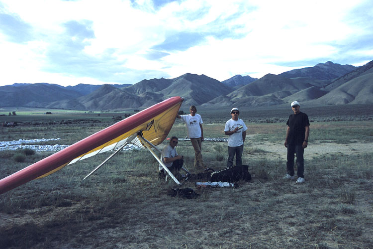
May Airstrip.
Kurt Bainum, Derk Steggewentz, Leo Jones and Greg Sugg at the bonus LZ.
The white rocks behind Kurt's glider mark the west end of the runway.
Photo © Ernie Camacho, June, 2002
"Dead Cow" LZ, near Challis.
Retrieving Kurt's glider after he hiked it out a couple miles to this crop circle. Bob Stanley, Larry Roberts, Albert Branson, and Kurt Bainum are shown.
Note: Please respect private property. Do NOT drive into irrigated fields. Try not to drive into any private fields. Pick your LZ.
Photo © Ernie Camacho, July, 2000
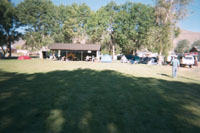
Town Park, Moore, Idaho.
For a week this park is ringed with pilots' vehicles.
Photo © Vince Endter, July, 2001
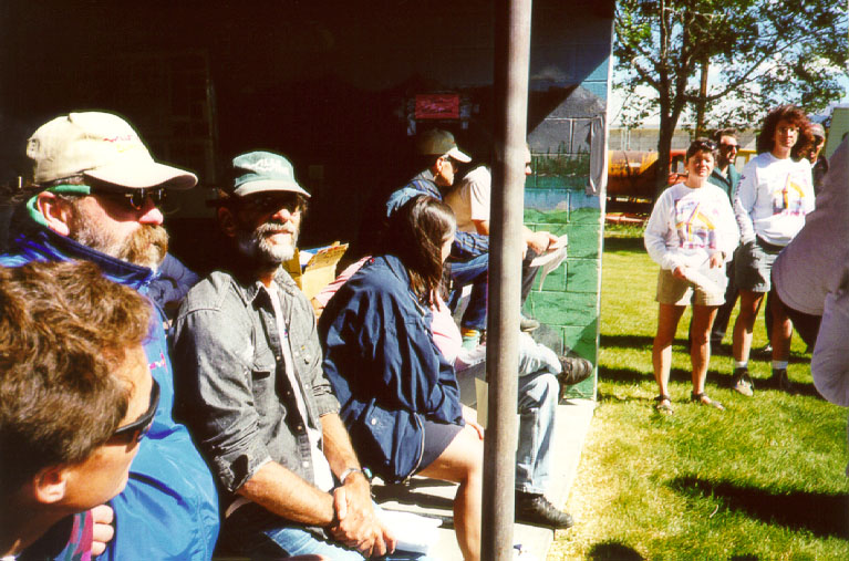
Meet headquarters, Moore, Idaho.
Heads in the photo, L-R: Scot Huber, Shannon Raby, Ken Muscio (who took 3rd in the meet). All three are scruffy California pilots. In the distance, facing the camera, are Liza Tate, Meet director, and Terri Edington, Launch Director.
Photo © Ernie Camacho, June, 1999