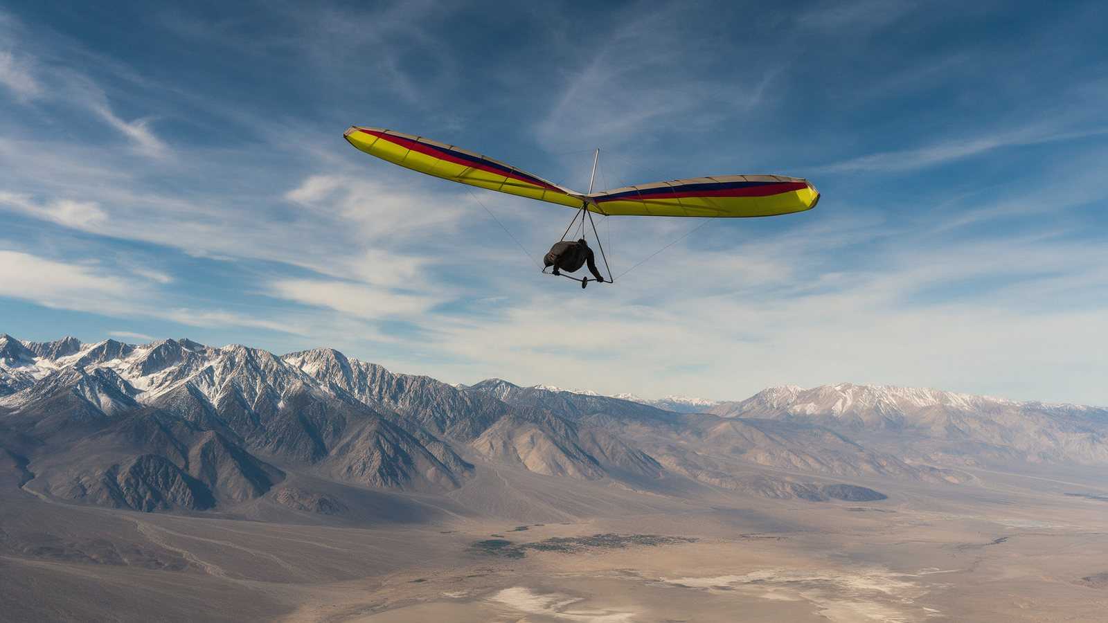
The Owens Valley, between the Sierra Nevada and the White Mountains near Bishop, is the most famous big-air flying area in the United States. Its launches near Bishop (Flynn’s, Gunter and Paiute) and Walt’s Point above Lone Pine have produced many distance and altitude records. This is advanced terrain. Summer thermals here can be violent, launches are high and remote, and no single club manages the sites, so you are responsible for your own judgment.
Overview
The valley floor sits around 4,000 ft, with the Sierra rising to the west and the White and Inyo Mountains to the east. XC Magazine’s guide puts cloudbase anywhere from about 13,000 to nearly 20,000 ft. The Lone Pine Chamber of Commerce says lift in the lower valley can take pilots to 18,000 ft, where hypoxia and extreme cold become real risks.
According to Visit Bishop, modern hang gliding came to the valley in the 1970s and it soon became “the Mecca” of the sport. Paragliders followed after the mid-1980s.
Our own club has history here. In early August 1997, eleven Sonoma Wings pilots made the drive for a long-planned trip, and you can read our club’s 1997 Owens Valley trip report.
Launches
The launches below are those we could verify in published pilot guides. Elevations vary a little between sources.
Flynn’s
Flynn’s is in the White Mountains east of Bishop Airport, at about 5,600 to 5,700 ft. It is the closest launch to town and the easiest to reach, though XC Magazine notes 4x4 access for the White Mountains launches. ParaglidingEarth describes a large launch with room for several gliders and windsocks visible from the LZ. Kari Castle’s guide calls it a “great site for beginning through advanced pilots” and warns to be careful in north winds. BHGC recommends H3, or H2 with an instructor. Visit Bishop notes Flynn’s is now also popular for speed flying.
Gunter
Gunter sits at roughly 7,900 ft above the valley north of Bishop. BHGC recommends an experienced H3 and describes a better road than Paiute, a shallow launch, a long glide to the LZ, and a launch that “often blows out.” Kari Castle’s guide mentions the possibility of landing out in the mountains.
Paiute
Paiute (also spelled Piute) is east of Chalfant Valley. XC Magazine gives about 8,000 ft, while BHGC lists an upper launch near 9,600 ft. ParaglidingEarth describes a big rocky launch about 4,000 ft above the LZ, thin air, small bushes that snag lines, and dust devils through launch late in the day. BHGC recommends H3 and a 4x4, warning that the road “regularly eats tires.”
Gunter and Paiute start working earlier than Flynn’s because they are higher. The White Mountain launches face west and work in the afternoon.
Walt’s Point
Walt’s Point is on Horseshoe Meadows Road above the Alabama Hills near Lone Pine, at about 9,000 ft. It is the only regular Owens Valley launch on the Sierra side and the only one with a paved road (BHGC). The Lone Pine Chamber states that launching here is “for ADVANCED hang glider pilots only,” and BHGC recommends H4 or an experienced H3.
Other launches exist, including Mazourka, Black Eagle, Cerro Gordo and the Alabama Hills, and Kari Castle’s guide adds McGee and Mammoth Mountain. Get local information before trying any of them.
Landing
Most flights end on the open valley floor. XC Magazine lists landing at about 4,000 ft. In summer the desert floor gets extremely hot and thermic, and landing late in the day can be rough. On cross-country flights, retrieves can be long, so arrange a driver and a radio or tracking plan.
Wind and season
XC Magazine recommends:
- Spring: May to early June for paragliders, with hang gliders flying into July.
- Autumn: September to mid-October.
- August: for very experienced pilots only. XC Magazine’s word is “Jedi.”
The Lone Pine Chamber describes the big-air season as roughly Memorial Day to Labor Day, with spring and fall better for less experienced pilots. Prevailing west winds spilling over the Sierra crest can create strong rotor behind spines and in canyons.
Check the forecast closely before every flight. Our weather links page collects the soaring forecast tools our club uses.
Records and cross-country history
The valley’s reputation was built on distance. XC Magazine notes that the first 100-mile and 200-mile flights in the United States, on both hang gliders and paragliders, started from Walt’s Point. The Lone Pine Chamber credits Larry Tudor with a long-standing men’s distance record set from Horseshoe Meadows in 1983, and Kari Castle with a 200-mile women’s flight from Walt’s Point to Austin, Nevada. Visit Bishop describes flights of hundreds of miles in ideal conditions.
Required experience and rules
There is no managing club or permit system for these launches. The Lone Pine Chamber describes Walt’s Point as self-regulated. That puts the decision on you. As a guide:
- Flynn’s: H3, or H2 with an instructor (BHGC).
- Gunter and Paiute: experienced H3 (BHGC).
- Walt’s Point: H4 or advanced pilots only (BHGC, Lone Pine Chamber).
Paraglider pilots should come with solid mountain thermal and active-flying experience, and should treat midday summer air with great caution. Carry a reserve, a radio and plenty of water. For long flights at high altitude, the Lone Pine Chamber warns about oxygen deprivation and cold. Our USHPA ratings guide explains what H3, H4 and the P ratings mean.
Airspace and access
Bishop Airport, about 2 miles east of town, has Class E airspace (XC Magazine). Kari Castle’s guide notes airspace limits near Mammoth Airport. Some launch roads are rough 4x4 tracks. Launches are on public land, so check Inyo National Forest alerts for road and fire closures before you drive up.
Instruction and tandem
The Lone Pine Chamber notes that instructor and world champion pilot Kari Castle offers tandem flights, clinics and instruction in the valley. If you are not yet ready for the Owens, our learn to fly guide covers the path from first lessons to mountain flying.
Hazards
- Extreme thermal turbulence and dust devils, especially in mid-summer afternoons.
- Rotor behind spines and in canyons with west wind over the Sierra.
- High launches, thin air and density altitude effects on launch and landing.
- Hypoxia and cold at very high altitude.
- Rough 4x4 roads, remote outlandings and long retrieves.
Our safety guide covers the general risk picture for the sport.
Nearby sites
On the west side of the Sierra, Dunlap is a good place to build mountain thermal skills before an Owens trip. Hat Creek offers big evening soaring further north. Our club’s home sites are in our site guides, and you can browse every listed site in our California flying sites directory.
Launch conditions, roads and access change from year to year. This guide was checked in October 2026. Ask local pilots and instructors in Bishop or Lone Pine about current conditions before you fly.
Frequently asked questions
Where do you hang glide in the Owens Valley?
The main launches near Bishop are Flynn's, Gunter and Paiute in the White Mountains on the east side of the valley. Walt's Point, on Horseshoe Meadows Road above Lone Pine, is the only regular launch on the Sierra side and is for advanced pilots.
What is the Owens Valley known for in free flight?
It is known for some of the strongest thermals and highest cloudbases in North America. The first 100-mile and 200-mile cross-country flights in the United States launched from Walt's Point, and many distance and altitude records were set in the valley.
When is the best time to fly the Owens Valley?
For paragliders, XC Magazine's guide recommends May to early June and September to mid-October, with hang gliders flying into July. High summer brings the biggest flights and the most violent air, which is suitable only for very experienced pilots.
What rating do I need for the Owens Valley?
There is no single managing club setting rules. Pilot guides recommend at least an H3 for Flynn's (H2 only with an instructor), an experienced H3 for Gunter and Paiute, and H4 or advanced pilots only for Walt's Point. Paraglider pilots should bring comparable mountain thermal experience.
Can I take a tandem flight in the Owens Valley?
Yes. The Lone Pine Chamber of Commerce notes that instructor Kari Castle offers tandem flights, clinics and instruction in the valley. Contact her program directly for current availability and prices.
Sources
- XC Magazine: Guide to Owens Valley, USA (2014)
- Bay Area Hang Gliding Club (BHGC): Owens Valley sites
- Lone Pine Chamber of Commerce: Hang Gliding in the Lone Pine Area
- Kari Castle: Owens Valley
- Visit Bishop: Bishop by Air
- ParaglidingEarth: Flynns (Bishop - Owens Valley)
- ParaglidingEarth: Paiute (Bishop - Owens Valley)
- Inyo National Forest: alerts and conditions