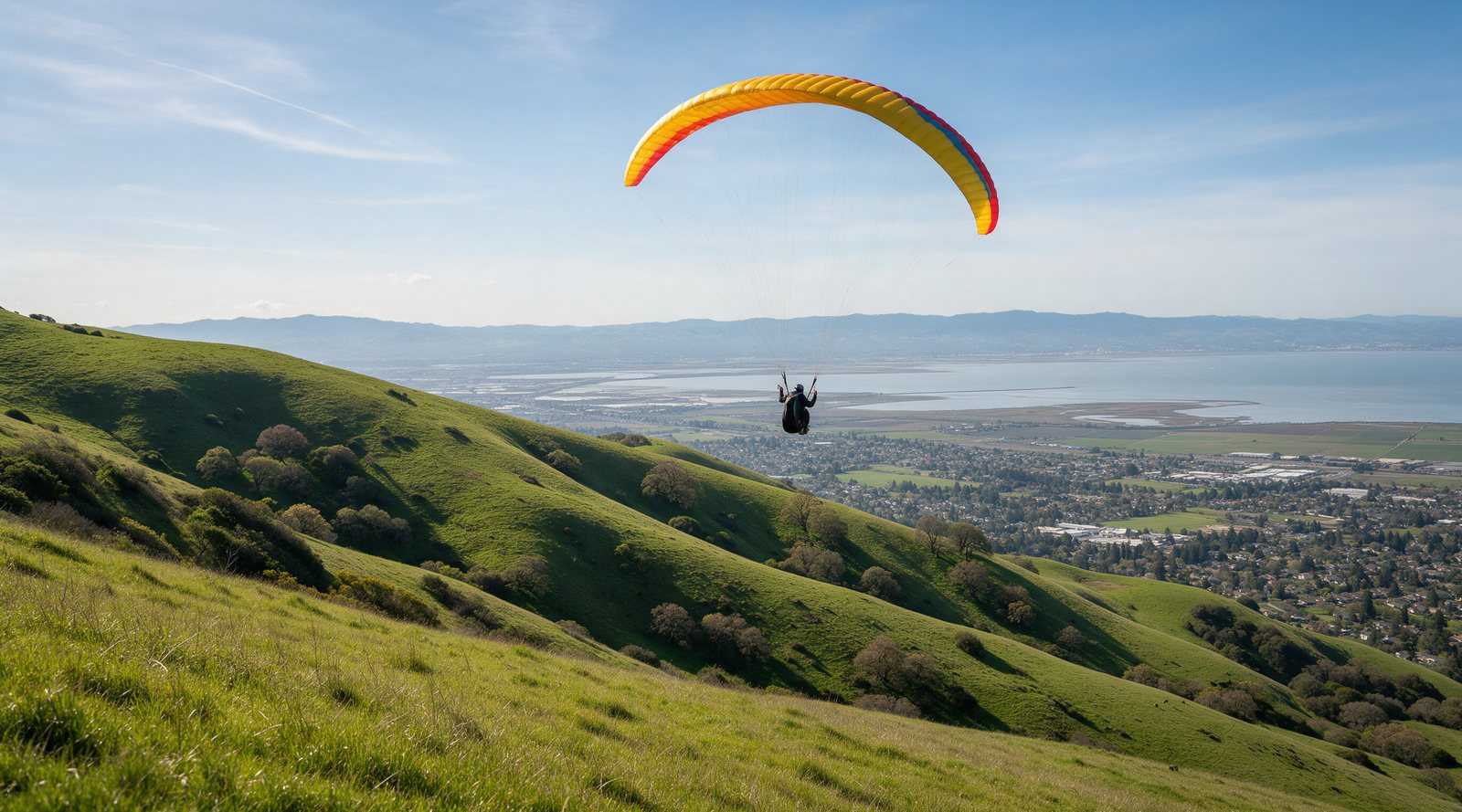
Ed R. Levin County Park in Milpitas is the Bay Area’s main training and inland flying site for both paragliders and hang gliders. Wings of Rogallo manages the flying, with launches ranging from small training hills beside the landing zone to the 1750 launches near Monument Peak. Students fly with instructors, and rated pilots need USHPA and club membership plus a county waiver.
Overview
Santa Clara County Parks describes Ed R. Levin as a 1,558-acre regional park with picnic areas, trails, fishing at Sandy Wool Lake and “a hang-gliding launch area” where visitors can watch hang gliders and paragliders. The Wings of Rogallo Ed Levin page says the site is open to pilots of all levels, from students through H5 and P5, with each launch carrying its own minimum rating. The Bay Area Hang Gliding Club site list lists it as “Ed Levin (Sled Heaven).”
Location and access
The park is in the hills east of Milpitas, open year-round from 8 a.m. to sunset. Wings of Rogallo lists a $6 vehicle entry fee and notes that tap-to-pay was not accepted as of its February 2026 update. There is a short-term parking and gear drop area near the LZ with a portable toilet and water, plus permanent restrooms near the main lot. Cattle graze the site, so give them space.
Pilots may hike in before the park opens, but flying hours are 8 a.m. to one hour before sunset, including packing and vehicle retrieval. The upper launch roads are locked. Gate codes go to members and change every February 1, and only high-clearance 4WD or AWD vehicles may use the 600 and 1750 roads. Those roads close after rain. Check the county park closures page or call the park before driving up.
Launches
Launch names refer to height above the LZ, which is about 540 ft MSL. Ratings and wind limits below are from Wings of Rogallo, checked October 9, 2026.
| Launch | Who can fly | Wind | Glide to LZ |
|---|---|---|---|
| Lower training hills (40, 50, 60 ft) | P3/H3, students with instructor, or P2/H2 with site intro | SE to W, 0-10 mph | short |
| 150 ft | P3/H3, P1/H1 with instructor, or P2/H2 with site intro | SSE to WSW, 0-10 mph | short |
| 300 ft | P3/H3, P1/H1 with instructor, or P2/H2 with site intro | SE to W, 0-12 mph | 3:1 |
| 600 ft (North, West, South) | P3/H3, P2/H2 with instructor, or P2/H2 with 3 flights over 300 ft AGL and site intro | SE to W, 0-15 mph | 3.5:1 |
| 1750 (North and South) | P3/H3, P2/H2 with instructor, or P2/H2 with 4 flights over 500 ft AGL and site intro | SE to W, 0-15 mph | 3.8:1 |
| 1750 Backside | P3/H4, or P2/H3 with instructor or with 4 flights over 500 ft AGL and site intro | NE to SE, PG 0-8 mph, HG 0-10 mph | 3.8:1 |
The club’s ideal speeds are lower for paragliders than hang gliders, for example 5 mph versus 10 mph at the 300. The 600 launches are technical, with rocks behind and below the North and West launches, and the South launch can sit in rotor in west wind. In any north wind, air comes up the launch road canyon and produces sink and turbulence on the other side of the ridge. From the Backside launch, turn right immediately after takeoff to avoid rotor. The 1750 area has a windsock and a webcam.
Landing
The LZ is large, flat and obstacle-free, and usable from every launch. Wings of Rogallo says the wind there is commonly light from the south in the morning, strengthening and clocking to west-northwest by early afternoon. Watch for rotor behind trees in south to southeast wind. Clear the LZ right after landing, since packing and ground handling are not allowed in the main landing area. P2 and higher pilots may kite on the west side of the LZ, west of the windsock. Two spot-landing targets with cones are set up for practice. Top landing is allowed at all launches when the launch area is clear.
Do not launch if the emergency “X” is displayed in the LZ. If you are already flying when it appears, land safely as soon as possible.
Wind and season
The typical pattern, according to the club, is light upslope wind and a strong inversion in the morning. In summer, the northwest Bay breeze usually arrives around 11 a.m. and often makes flying unsafe. In winter the site is rarely soarable except in pre-frontal conditions, and post-frontal days often mean the road to the top is closed. In spring and fall, soarable days are frequent when the wind is from the south. Summer soaring is limited by the inversion.
For live and forecast data, the club links its WindSlammer station at the 1750, the nearby Mt. Allison weather station (closest but not always representative), the Oakland sounding and a Windy airgram. Our weather links page explains how we use soundings and forecast models.
Required rating and rules
From the Wings of Rogallo Ed Levin page and visiting pilot page, checked October 2026:
- Current USHPA membership and Wings of Rogallo full or visiting membership.
- Visiting pilots must be accompanied by a full WOR member. Visitors may fly WOR sites free for up to two days a year.
- Everyone at the site, including spectators and drivers, must sign the Santa Clara County Parks Ed Levin waiver. Visiting pilots should carry a printed copy.
- Pilots must be 18 or older.
- Fly with a helmet and reserve, launch only from designated launches, follow FAR Part 103, and report accidents or incidents to the club.
- No commercial activity without a county permit. Instructors need club approval through the site chair.
Site intros for P2 and H2 pilots must come from a full WOR member with a P4 or H4 rating and at least two years of flying at Ed Levin, among other criteria. Pilots with both ratings may follow the requirements of the higher one. Our USHPA ratings guide explains the P1 to P5 and H1 to H5 levels.
Airspace
Wings of Rogallo sets a maximum altitude of 6,000 ft over Ed Levin, with nearby airspace floors at 5,000 ft and 7,000 ft. Expect general aviation and helicopter traffic, and carry an instrument that shows airspace if you can.
Hazards
- The midday northwest Bay breeze, which can arrive quickly and strongly.
- Rotor at the South 600 in west wind, behind the Backside launch, and behind LZ trees in southerly wind.
- Mixed paraglider and hang glider traffic on the same approach. Site intros cover landing patterns for both.
- Cattle in the launch and landing areas.
- Air traffic above the site.
The club keeps a first aid kit in a lockbox in the LZ. Ask a member where it is during your site intro.
Nearby
Wings of Rogallo also manages Mission Ridge in Fremont, an H4/P4 site (H3/P3 with additional requirements) flown under a special use agreement with the East Bay Regional Park District. On the coast, paraglider pilots head to Mussel Rock and hang glider pilots to Fort Funston. If you are starting out, our learn to fly page explains how training works, and California flying sites lists where to go next, including our own St Helena site near Calistoga.
Frequently asked questions
Can beginners fly at Ed Levin?
Yes, it is one of the few Bay Area sites open to students. Wings of Rogallo allows student pilots on the lower training hills with an instructor, and P2 and H2 pilots can fly higher launches after meeting experience requirements and getting a site intro. Visiting pilots must fly with a full Wings of Rogallo member.
Who manages Ed Levin for hang gliding and paragliding?
The Wings of Rogallo club manages flying at Ed R. Levin County Park, which is run by Santa Clara County Parks. Pilots need current USHPA membership, Wings of Rogallo full or visiting membership, and a signed county park waiver.
What is the best time of day to fly Ed Levin?
Wings of Rogallo describes light upslope wind and a strong inversion in the morning, then a northwest Bay breeze that builds around 11 a.m. in summer and often makes flying unsafe. Soarable days are frequent outside winter when the wind is from the south. Winter flying is mostly sled rides except before fronts.
How much does it cost to fly at Ed Levin?
The park charges a $6 vehicle entry fee, according to the Wings of Rogallo site page updated in February 2026. Visiting pilots can fly Wings of Rogallo sites free for up to two days a year, then the club asks you to join as a full member.
How high is the 1750 launch at Ed Levin?
The launch names are heights above the landing zone, which sits at about 540 ft MSL. The 1750 launches are about 1,750 ft above the LZ, with a published glide ratio of about 3.8 to 1. They are reached by trail or by high-clearance vehicle on Monument Peak Road.