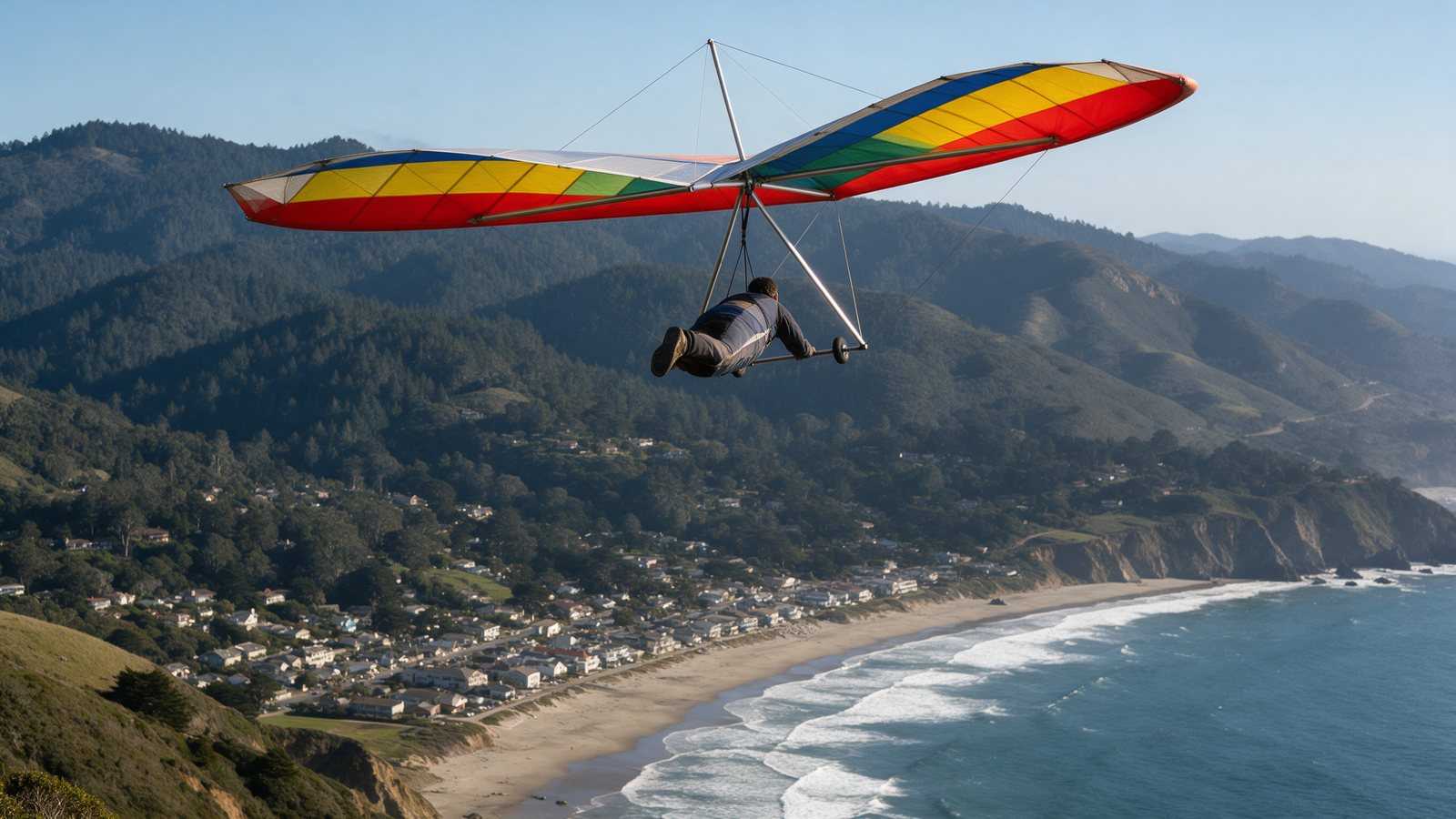
Mount Tamalpais in Marin County is the Bay Area’s classic mountain flight: launch from Bolinas Ridge at about 2,000 ft and glide down to the beach at Stinson Beach. Flying is allowed, as of October 2026, under special use permits held by the Marin County Hang Gliding Association (MCHGA). You need an MCHGA sticker, a site intro, and an H3, P4, or P3 with a sponsor sign-off.
Overview
MCHGA’s site guide, revised February 18, 2026, rates Mt. Tam as an intermediate (H3/P3) site for both hang gliding and paragliding. The club says it maintains special use permits with state and county agencies for flying on the west side of the mountain along Bolinas Ridge. Its flight rules name California State Parks and the County of Marin as the permitting agencies and state that all commercial activity is forbidden. Paragliding has been administered and regulated by MCHGA since May 2016, and the club combined its separate hang gliding and paragliding rules into one document in early 2026.
The views reach across the ocean to San Francisco and the bay. In light wind the site is forgiving. In stronger wind, the ridges between launch and beach make it turbulent.
Current status and permits
As of October 9, 2026, the MCHGA site is open to qualified pilots. Recent changes posted on the MCHGA bulletin board include:
- Online daily sign-in with the rangers, at mchga.org/signin, in addition to the paper sign-in box at the Pantoll Ranger Station.
- The “5-glider rule,” which limited how many gliders could be out of the bag at each launch, was rescinded after the club worked with the Park Service.
- Commercial instructors may not bring students to Tam unless they provide site insurance, accept no compensation for Tam activity and are approved by the club.
- The club’s own weather station has been taken out of service.
- A new windsock was posted at the end of the beach alleyway in late 2024, and the Seadrift boundary sign at the north end of the LZ was replaced in April 2026.
Rules and permits on public land can change quickly. Check the MCHGA site or ask a club officer before every trip.
Location and access
From Highway 101 in Mill Valley, MCHGA directs pilots to the Stinson Beach/Highway 1 exit, west on Highway 1, then up Panoramic Highway to the Pantoll Ranger Station. From Pantoll, take Pantoll Road 1.4 miles to Rock Spring and turn left on West Ridgecrest Boulevard. A launch is 0.4 miles along, B launch 0.3 miles further and plainly visible beside the road, and C launch 0.9 miles beyond that.
Launches
All three launches sit at about 2,000 ft MSL and are rated H3/P3. MCHGA publishes these wind limits:
| Launch | Faces | OK direction (ideal) | Wind limits |
|---|---|---|---|
| A | South | 155-190 deg (170-180) | HG: max 25 mph, ideal 20. PG: max 15 mph. Gust 5 |
| B | West | 225-300 deg (260-270) | Both: max 15 mph, ideal 10, gust 5 |
| C | West | 240-310 deg (265-275) | Both: max 15 mph, ideal 10, gust 5 |
No-wind launches are common. The club says pilots generally avoid west wind over 15 mph and south wind over 25 mph because of turbulence. Paraglider pilots should not launch in wind over 15 mph, and hang glider pilots need an advanced-rated pilot present to keep flying above 15 mph. Launching from the back (north or east) side of any launch is prohibited.
MCHGA’s published launch points, for reference: A at 37.907204, -122.620107; B at 37.910665, -122.624995; C at 37.920838, -122.63266.
Landing
The LZ is on the beach near the north end of Stinson Beach, at or south of Walla Vista. Landings must be south of the Seadrift private beach and north of the GGNRA’s Stinson Beach park. MCHGA describes the strip as about 3,400 ft long and 40 to 50 yards wide at average tides, the width of about four hang gliders side by side. The tall metal sign marking the Seadrift boundary is an obstacle, so land south of it.
Rules for the LZ:
- Head out with enough height to clear the beach houses by at least 100 ft, and burn off extra altitude over the beach or water, not over houses.
- Do not fly when the LZ is crowded or not visible from launch. Land at least 30 ft from other beach users.
- Fold up quickly and leave via the Walla Vista public access. Retrieve vehicles park on Calle del Arroyo south of the Walla Vista alleyway.
- Check the NOAA tide table before you fly. MCHGA notes there is no single safe tide level because the sand level changes.
Wind and season
MCHGA and Bay Area Paragliding both name winter and spring as the best season, when storms bring unstable air. Post-frontal days often turn northwest, which creates the site’s best-known hazard: a rotor just off B launch, caused by northwest wind wrapping around Ballou Point. It can make the wind on B launch look like a clean west breeze. MCHGA warns it can cause a sudden loss of control or a collapse at low altitude, and that it cannot be avoided except by not launching in that pattern.
Other wind notes from the club: strong gradients near the beach, where wind can drop to zero, and reverse gradients, where whitecaps on the water mean stronger wind below than at launch. Look for wind lines on the water before and during the flight. With the club’s station gone, the Bay Area Hang Gliding Club site list links public wind stations, buoys and wildfire webcams around the mountain. Our weather links page collects the tools we use for coastal and mountain sites.
Required rating and rules
From the MCHGA Flight Rules and Procedures and Pilots and Stickers page, checked October 2026:
- Current USHPA membership, helmet, reserve and an airworthy glider.
- Hang gliders: H3 minimum, or H2 with an MCHGA-approved Tam instructor under the novice program. Novices need prior experience, may not fly on weekends or holidays, and only one novice may be in the air at a time.
- Paragliders: P4, or P3 with a completed sponsor sign-off. There is no way to fly Tam solo as an unrated, H1, P1 or P2 pilot.
- A current MCHGA sticker, which the club recommends placing on the left side of your helmet. Stickers require a signed paper waiver (no fax or email) and an annual fee. The fee may be waived for qualifying visiting pilots.
- A site intro from an authorized club pilot before your first flight. Only listed officers, sponsors and instructors may give one.
- Daily sign-in with the rangers before your first flight of the day.
- Mini wings, speed wings and powered flight are prohibited. No bank over 60 degrees or pitch over 30 degrees west of Highway 1.
- Do not fly over the town of Stinson Beach or the cliffs south of town. Violations can bring citations from State Parks or the CHP.
Our USHPA ratings guide explains what an H3, P3 or P4 involves.
Hazards
- Rotor at B launch in northwest wind.
- Turbulence from crossing ridges when the wind is over about 15 mph, and very rough post-frontal air.
- Wind gradients and headwinds near the beach, which can stop your penetration to the LZ.
- High tides and king tides that cover the landing beach.
- Crowded beaches on warm weekends and holidays.
- Rapid weather change. Bay Area Paragliding recalls a funnel cloud forming quickly after conditions had seemed good.
Nearby
South of the Golden Gate, Fort Funston is the coastal ridge site for hang gliders and Mussel Rock for paragliders. Our own sites are north in Sonoma and Napa: coastal Goat Rock and the mountain site at St Helena. For a statewide list, see California flying sites.
Frequently asked questions
Is hang gliding and paragliding allowed on Mount Tam?
Yes. As of October 2026, the Marin County Hang Gliding Association holds special use permits with California State Parks and the County of Marin that allow non-commercial hang gliding and paragliding from the west side of Mt. Tam. Every pilot needs a current MCHGA sticker, a site intro and a daily sign-in with the rangers.
Can you paraglide off Mount Tamalpais?
Yes, under MCHGA rules. Paraglider pilots need a USHPA P4, or a P3 with a completed sponsor sign-off from an approved MCHGA sponsor. Paragliding at Tam has been administered by MCHGA since May 2016, and pilots should not launch in wind over 15 mph.
Where do you land when flying from Mount Tam?
The landing zone is the beach near the north end of Stinson Beach, south of the Seadrift private beach boundary sign and north of the GGNRA Stinson Beach park. MCHGA describes a strip about 3,400 ft long and 40 to 50 yards wide at average tides. Check the tide table first, since high tides can cover it.
Can I book a tandem hang gliding flight from Mount Tam?
No commercial flying is allowed under the MCHGA permits, so there are no paid tandem rides from Tam. Non-commercial instructional tandems are allowed only for properly rated, certified non-commercial instructors following USHPA and FAA rules. For a tandem, look at schools at other Bay Area sites.
What is the best season to fly Mount Tam?
MCHGA says winter and spring are best, when storms bring unstable air and good soaring. Light-wind days are forgiving, but the club warns that crossing ridges make the air turbulent whenever the wind is over about 15 mph, especially for paragliders.