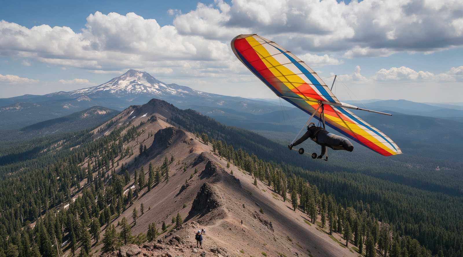
Hat Creek Rim is a long, west-facing volcanic ridge about an hour east of Redding, and it is the classic Northern California summer site for evening glass-off flying. It is managed by the Hat Creek Pilots Association (HCPA), a USHPA chapter, and requires an H3 or P3 rating, USHPA membership and a signed club waiver. Strong afternoon wind and rough lava terrain make it a site for prepared intermediate pilots, not a casual stop.
Overview
The rim runs along the east side of the Hat Creek valley in Shasta County, with Mount Shasta to the north and Lassen Peak to the south. Its main draw is the evening glass-off. As the valley cools, the wind eases and smooth lift spreads over a wide area. Sierra Hang Gliding describes lift “everywhere” from about 6:30 pm to sunset and flights of an hour or more. Airtime Paragliding reports typical climbs of 500 to 1,000 ft above the rim, and more than 2,000 ft on exceptional evenings.
HCPA calls it a high desert site that can be flown nearly year round, with summer offering the most consistent conditions. Airtime lists the main soaring season as May through September.
Location and access
The HCPA site guide places launch about 10 miles east of Highway 89 near the town of Hat Creek, on Forest Route 22 off Bidwell Road. The club notes the launch area is national forest land. From the Bay Area, the usual route is I-505 and I-5 to Redding, then Highway 299 east and Highway 89 south. A large dirt road connects the landing zones and launch, and the main LZ (LZ 2) is the usual meeting point.
HCPA gives launch coordinates of 40°50’34.9”N 121°25’38.2”W. ParaglidingEarth and BHGC list nearly identical positions. Verizon coverage is described as spotty, so plan your meeting time before you lose signal.
Launch
Launch is a west-facing gravel slope at about 4,500 ft MSL (HCPA). The club lists an ideal wind direction of WSW to WNW. For hang gliders the ideal speed is around 14 mph, and for paragliders around 7 mph. Strong, gusty launch winds are the main challenge, which is why the club recommends the Assisted Windy Cliff Launch (AWCL) skill. A wind meter matters here; Sierra Hang Gliding calls launch wind speed “critical.”
Landing
HCPA lists three landing zones:
- LZ 1, about 3,490 ft, the closest at roughly a 3:1 glide, ringed by trees.
- LZ 2, about 3,570 ft, the primary LZ at roughly a 7:1 glide, a large open field with a windsock.
- LZ 3, about 3,860 ft, an emergency bail-out only, with poor road access.
Airtime warns that LZ 1 is surrounded by trees around 80 ft tall. Expect wind gradient and mechanical turbulence near the trees. Fields that look like smooth yellow grass often hide broken basalt, so knee pads and long pants are a sensible choice. Top landing is not allowed.
Wind and season
Most flying happens in the evening. Afternoon winds of 15 to 30 mph are common in summer (Airtime), and pilots wait for them to drop. In a 2014 forum thread, experienced hang glider pilots described midday flights too. They reported climbs to around 8,000 ft as common, with flights usually heading northeast toward Alturas, downwind and away from the lava beds. The same pilots warned that landing in LZ 1 or 2 at midday can be very thermic and that outlanding fields hide rocks. One trip write-up notes that if you are blown too far downwind, the next road can be about 40 miles away over volcanic terrain. Midday cross-country here is for experienced pilots with a retrieve plan.
Our weather links page lists the forecast tools our club checks before an inland trip.
Required rating and rules
From the HCPA site guide, checked October 2026:
- Minimum H3 or P3, with current USHPA membership.
- H2 and P2 pilots fly with an HCPA-appointed sponsor. Their first six flights must be before 10 a.m. or after 6 p.m. (7 p.m. for hang gliders).
- Recommended skills: AWCL, Turbulence (TUR) and Restricted Landing Field (RLF).
- An airworthy glider, reserve and helmet are required.
- Radios are recommended. The local frequency is 146.415.
- No commercial tandems without separate insurance.
- No top landings.
- Land immediately if firefighting aircraft appear.
Our USHPA ratings guide explains the ratings and special skills mentioned above.
Managing club and fees
The Hat Creek Pilots Association describes itself as the official USHPA chapter and local club for the rim. Starting in 2025, every pilot must sign the HCPA chapter waiver and join or renew membership each year. The club home page lists annual membership as a suggested $20 donation, which pays for site maintenance, improvements and club events. Foreign pilots without USHPA membership can get a temporary USHPA membership.
Fly-ins and the Fourth of July
We did not find an official HCPA fly-in on the calendar for 2026. One pilot write-up describes the Fourth of July weekend as a traditional time to visit, with “a big crowd of pilots” and several groups of hang glider and paraglider pilots arriving together. Clubs and schools also run organized trips here. Mission Soaring ran one in 2015 that asked for at least an H2 with H3 accuracy landings and prior Ed Levin flights. If you want company or a site intro, contact HCPA through its website, Telegram, Signal or Facebook channels.
Camping and facilities
Sierra Hang Gliding describes a huge main LZ that allows open camping, with outhouse facilities. Airtime suggests Hereford Ranch and RV Park and Rancheria Campground. Restaurants close early in the area, so bring dinner.
Hazards
- Strong, gusty launch winds. South crosswinds are especially dangerous (HCPA).
- Wind gradient and tree turbulence on approach to LZ 1 and LZ 2.
- Strong midday thermals and high density altitude on hot days.
- Lava rock in landing fields and remote terrain downwind. HCPA states plainly that “the terrain is unforgiving.”
- Fire season. Firefighting aircraft take priority.
The closest emergency room listed by HCPA is Mayers Memorial Hospital in Fall River Mills. Read our safety guide for the general habits that keep pilots out of trouble at sites like this.
Nearby sites
Many Northern California pilots build up to Hat Creek at Ed Levin, and Mission Soaring used it as a prerequisite for its trip. Further south, Dunlap is another inland thermal site, and the Owens Valley is the big step up. Our own club flies the North Bay sites in our site guides, and the full list is in our California flying sites directory.
Rules and fees here were checked in October 2026. Confirm current conditions and requirements with the Hat Creek Pilots Association before you go.
Frequently asked questions
Where is Hat Creek Rim?
Hat Creek Rim is a west-facing volcanic escarpment in northeastern California, about an hour east of Redding near the small community of Hat Creek. The launch is on Forest Route 22 off Bidwell Road, roughly 10 miles east of Highway 89, between Mount Shasta and Lassen Peak.
What rating do you need to fly Hat Creek?
The Hat Creek Pilots Association requires at least an H3 or P3 rating and current USHPA membership. H2 and P2 pilots must fly with an HCPA-appointed sponsor and have time-of-day limits on their first six flights. The club also recommends the AWCL, TUR and RLF special skills.
When is the best time to fly Hat Creek?
Most pilots fly the evening glass-off, roughly 6:30 pm to sunset in summer, when the wind eases and smooth lift covers the valley. The club says summer gives the most consistent conditions, and pilot guides list May through September as the main season.
Is there a Hat Creek fly-in?
We could not find an official, scheduled HCPA fly-in for 2026. Pilot write-ups describe the Fourth of July weekend as a traditional time when large groups of hang glider and paraglider pilots gather at the rim. Check the club's channels for any planned events.
Can you camp at Hat Creek Rim?
Pilot guides describe a very large main LZ with open camping and an outhouse. Airtime Paragliding also suggests Hereford Ranch and RV Park and Rancheria Campground nearby. Confirm camping rules locally, especially during fire season.
Sources
- Hat Creek Pilots Association (home page)
- Hat Creek Pilots Association: Site Guide
- Airtime Paragliding: Hat Creek site guide
- Sierra Hang Gliding: Hat Creek Rim, Lassen
- Bay Area Hang Gliding Club (BHGC): Flying Sites
- Hang Gliding Org forum: Hat Creek Mid Day (2014)
- Paragliding at Hat Creek Rim, California (Steemit)
- Mission Soaring: Hat Creek trip (2015)
- ParaglidingEarth: Hat Creek rim