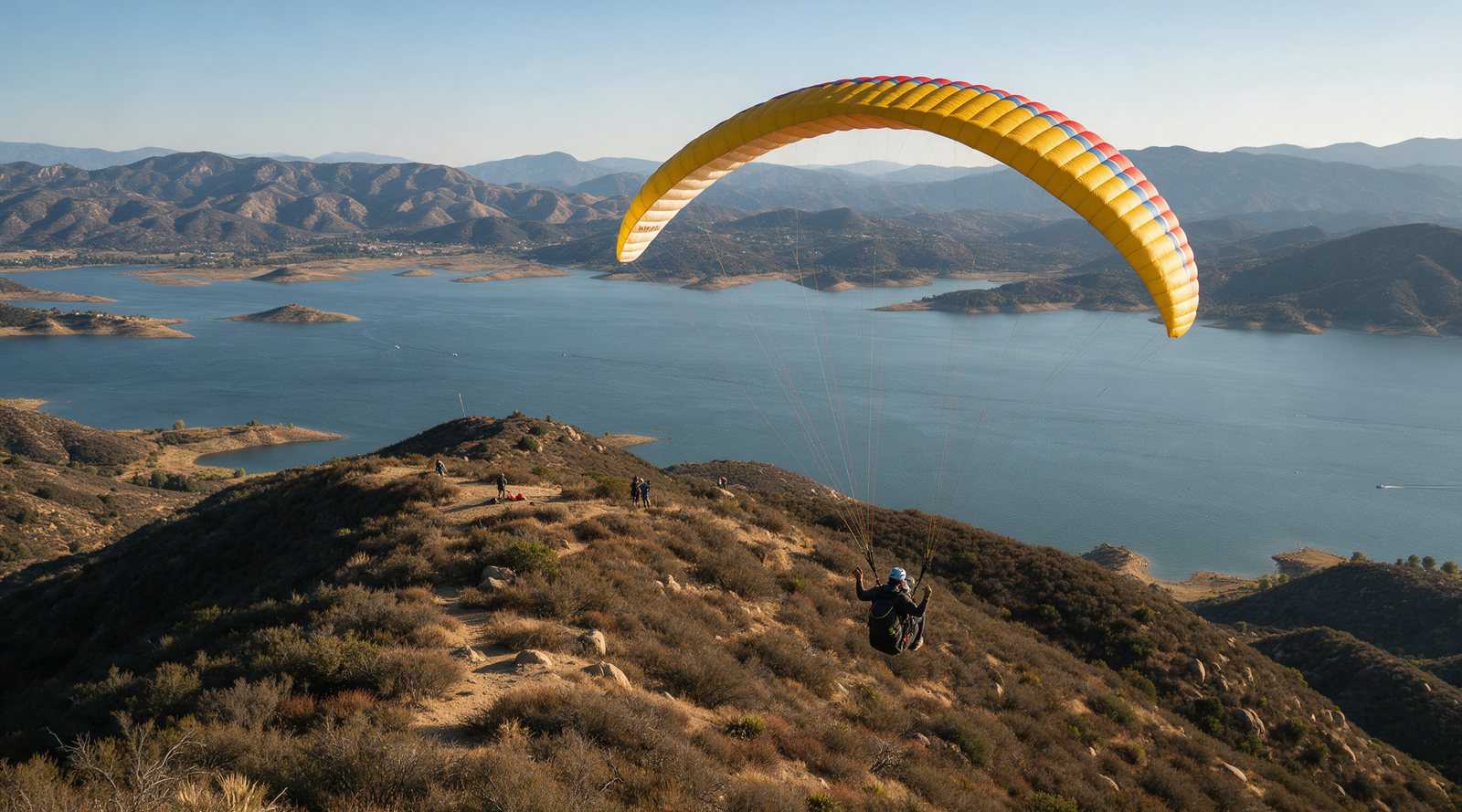
Lake Elsinore, in Riverside County, is one of Southern California’s busiest thermal and cross-country sites. Pilots launch from the E or Edwards on the ridge west of the lake and land on the valley floor near Grand Avenue. The site was active in October 2026, but it is unregulated and the main landing zone is privately owned, so visitors should fly quietly, follow local etiquette and get a briefing first.
Overview
The launches sit on the east face of the Santa Ana Mountains (locals often say the Ortega Mountains), about 1,500 ft above the valley. The Southern California XC League describes a convergence line that forms across the valley toward Soboba, with climbs often passing 10,000 ft. It treats Elsinore as one of the core cross-country sites in its league.
Flight data compiled by Wilder Adventures from tracklogs shows an average of about 16 cross-country days a year. Its longest recorded paraglider flight is 188 km, flown on August 1, 2021. August through October show the most activity, and several flights over 80 km were logged in October 2026.
Location and access
Pilots usually meet at Highway 74 (Ortega Highway) off Grand Avenue in the Lakeland Village area, then drive up Highway 74 to the launches. The SoCal XC League notes that the main launches are on National Forest land and that you need a National Forest parking pass to park there. ParaglidingEarth places the launch area at about 33.630, -117.371 (site 6940). Use that for orientation and follow local directions on the day.
Launches
Two launches are in regular use:
- The E, at about 2,857 ft. It works in east to northeast wind. The SoCal XC League calls it “very small, better for hang gliders,” and Jerome Daoust’s site page notes that the short launch means you need lift to make it to the LZ.
- Edwards, at about 2,788 ft, a little south of the E. It works in east-southeast to east wind and is larger and more forgiving. Pilots sometimes call the area around it Edwards Bowl.
Unofficial launches also exist along the road and on nearby peaks. Do not try them without a local pilot.
Landing
According to the SoCal XC League, the main LZ is privately owned. Pilots are asked to be discreet, and kiting in the LZ is discouraged because it draws attention. Jerome Daoust’s page lists the Grand Avenue LZ as the primary landing area, with an alternative known as Mike’s LZ. It also warns that the Oak Tree LZ has been in litigation since 2018 and says “DO NOT LAND THERE.” Landing options here can change, so ask locals which fields are in use before you launch.
A long-time local hang glider pilot described summer landings as “very tricky” and demanding full concentration (Hang Gliding Org forum, 2014).
Wind and season
Elsinore is an east-wind site. The usual summer pattern, described by that same local pilot, is a morning east-southeast wind that reverses to westerly between about 11 am and 1 pm. Launch too early and you may sink out. Launch too late and you will be on the lee side. The SoCal XC League recommends launching before noon in east winds and staying up until the westerly sea breeze arrives and sets up the convergence and cloud streets.
Wilder Adventures’ tracklog statistics show the most cross-country days from late spring to fall. Strong east winds in fall and winter, and northerly flow at the E, can make the air dangerous (see Hazards). Our weather links page lists the forecast tools we use.
Required rating and rules
We found no published minimum rating from a managing club as of October 2026. The SoCal XC League describes Elsinore as an unregulated site with “unwritten rules” that local residents may enforce. Jerome Daoust’s page notes that insurance requires USHPA membership. Locals describe the site as technical, so a sensible plan is to arrive with solid launch and thermal skills and fly your first day with a local school or experienced pilot. Our USHPA ratings guide explains what P2, P3, H2 and H3 involve.
Good habits for visitors:
- Be quiet and low-key around the LZ and neighbors.
- Do not land in fields that locals have marked as off limits.
- Before crossing the lake on a cross-country flight, call the drop zone (see Hazards).
- Use the site radio frequency that local pilots use. Jerome Daoust’s page lists 144.120.
Managing club and fees
The site has historically been supported by a local club known as the “E” Team. Its web presence was already described as outdated in 2014, and we could not find a current club website in October 2026. We also found no published site fee. Local schools and Southern California clubs such as the Crestline Soaring Society are the best places to ask about current arrangements. For general costs, see our hang gliding cost guide.
Hazards
- Skydiving traffic. A Crestline Soaring Society post from November 2024 asks pilots who plan to cross the lake to call the Elsinore drop zone before launching, or to announce on 122.9 with an aviation radio. Three more drop zones operate within 20 miles.
- Military restricted airspace near March Field to the northeast, plus sailplane, power and military traffic.
- Rotor in northerly wind. Jerome Daoust’s page warns of a “Tuck Zone” on the south side of the E launch spine.
- The midday wind reversal, which can leave late launchers on the lee side.
- Summer heat and thermic landings.
- Private land and sensitive neighbor relations around the LZ.
Our safety guide covers how pilots manage these kinds of risks.
Nearby sites
Further south, Torrey Pines Gliderport offers coastal ridge soaring with a very different feel. For big inland thermal flying elsewhere in the state, see Dunlap and the Owens Valley. The full list is in our California flying sites directory.
Site access, landing zones and protocols at Elsinore change. This guide was checked in October 2026. Confirm current rules with local pilots or schools before you fly.
Frequently asked questions
Where do paragliders launch at Lake Elsinore?
The two main launches are the E and Edwards, on the ridge of the Santa Ana Mountains above the west side of the lake, reached via Highway 74 (Ortega Highway). The E is small and better suited to hang gliders, while Edwards, a little further south, is larger and more forgiving.
Is Lake Elsinore still open for paragliding?
Yes. Pilots were logging cross-country flights from Elsinore in October 2026. The site is unregulated and the main landing zone is privately owned, so access depends on pilots behaving well. Check with local pilots or schools before your first visit.
What wind does Lake Elsinore need?
The launches face east. The E works in east to northeast wind and Edwards in east-southeast to east. On many summer days the morning east wind reverses to westerly between about 11 am and 1 pm, so launch timing matters.
Do I need a rating to fly Lake Elsinore?
We found no published minimum rating from a managing club. Pilots need USHPA membership for insurance, and long-time locals describe the site as technical. Visitors should come with thermal experience and fly first with a local school or pilot.
Why do I need to call the skydiving drop zone?
Skydive Elsinore operates next to the lake, and three more drop zones are within 20 miles. Since late 2024, pilots planning to cross the lake on cross-country flights are asked to call the drop zone before launching, or to announce on 122.9 if they carry an aviation radio.
Sources
- Southern California XC League: Lake Elsinore Info
- Jerome Daoust: Elsinore, California, USA site page (updated January 2025)
- Crestline Soaring Society: Elsinore protocols update for calling the DZ (November 2024)
- Wilder Adventures: Lake Elsinore paragliding XC statistics
- Hang Gliding Org forum: Visit to Lake Elsinore (2014)
- ParaglidingEarth: Elsinore